
What a day! Normally I hate uphills but the uphill to San Pere de Rodes was surprisingly different.
The Camino starts in El Port de la Selva at a sign in the port.


I cheated and took these photos the day before, when I started I got a taxi from Llanca to the campsite at Port de Val. It's 3 kms from El Port de la Selva and where the path starts to go uphill. At first it was not signed but my guide said to walk to Val de St Creu which was what I was doing. When I got there the footpath went off to Sant Pere de Rodes.
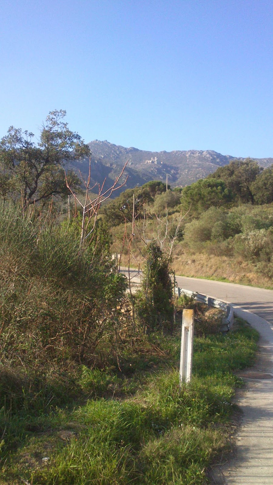
It was signed with little yellow lines. It was a very steep narrow path. Normally when I walk uphill my legs and my brain don't coordinate, my brain says I'll just walk to there and stop but my legs just stop but today there was no stopping. Admittedly I was walking very slowly.
The footpath was very narrow and sometimes it was just smooth rock with a big drop at the side.

 this was the path in places.
I had been worried about walking in hot sunny weather but on this climb I was very grateful that the path was not wet, it would have been very dangerous and I would never have managed it.


Looking up! Looking back
Eventually I got to the monastery, it had been an incredible walk and the monastery is well worth the visit.


The coming down was horrendous, it started by walking up to this other chapel.
 views from the other side.
 The path had been re-signed in places with these signs.
Shortly after this the downhill really started. The idea of walking downhill doesn't seem so bad but this was long and steep and seemed to go on forever. For a while I thought I was on the wrong path, I was following the same little yellow lines but it said 'Circuito Megalitico ' or something. There was nothing I could do, I wasn't going to go back up but I was very grateful when I saw a camino sign, and equally glad when I got down. I discovered then that the walk down is 6.5 kms. Sant Pere is at 670 metres, the walk up is 3.5 kms the walk down 6.5 !!! I was too busy concentrating on the path to take photos!!
I arrived in the town of Pau and stopped for a drink and a rest.

Whilst I was in the bar another 'pilgrim' appeared, but he was walking from Lisbon to Berlin and was just about to walk up to San Pere.
I spent all day a little confused as my notes said I should go to somewhere called Vilabertran but I didn't, not till later anyway. I had 'cut' and 'pasted' info from the Catalan Tourist guide and somehow I had pasted this info in the wrong place.
After Pau it was flat, easy and well signed. I had hesitated about whether to stop in Vilajuiga, after 15 kms or go onto Perelada at 24 kms. I decided to continue to Perelada as it is more interesting and would cut down the next day.
 One of the common signs
Unfortunately Perelada is a tourist town, the hotels were either full or too expensive! I ended up having to walk nearly to Figueres, by then I really was exhausted.
The wind started to blow a real gale, the Tramuntana had arrived.
Day 2 Vilabertran to Bascara +/-22 kms
The wind howled all night. I used my earplugs but it was still really loud. I discovered this morning that my window had blown open, which was why I was listening to it in glorious techni-sound. When I left the hotel I was nearly blown over. For a while it was coming from the front, which made walking really difficult, then it was coming from the side so I had to lean into it to stop being blown off the path.

I walked back to Vilabertran,
 about 2 kms, to pick up the camino, then I headed to Figueres.


By the time I left Figueres the wind had dropped, there were still gusts but between times it was easier. My legs are very tired today, I think yesterday I was on a high. My info said I would walk from Figueres to Santa Llogadia, which I took to be the next town, but there was one called Vilafant before which had much better facilities. including a butcher who would stamp credenciales, but this was Sunday!

When I got to Santa Llogadia I could see nothing and the camino didn't even go in, but then I saw a church so I went to investigate as I was desperate to sit down, I found a bar so I stopped there and had a coffee and a rest. The big advantage today is that the villages are fairly regularly spaced out so it is lots of little bite size pieces.
Signing today is arrows, plus the blue signs that crop up regularly. Mostly it is very well signed it is just in the villages that it can be confusing. My info is a download of a brochure produced by the Catalan Tourist office in 2010, so some of it has changed. There aren't many albergues on this stretch and Eroski doesn't have info before Monserrat so I have nothing up to date.
I got lost a bit in a couple of villages, once because I failed to see the arrow and once because there simply weren't any.
I was exhausted when I arrived in Bascara and desperate for a drink as I had run out of water for the last few kms. I was aiming for Pension Fluvia and I found it almost at once. They are really friendly and there is a restaurant so I could have lunch. I didn't have a proper meal yesterday, just frequent snacks, so I was glad to feel I had eaten properly. After lunch I had a siesta, this was taken to a background cacophony of poultry, I think they belong to the restaurant so it's fresh produce here.

Then I went to visit the town, it is very picturesque, an old walled town with castle, though not much remains of the castle.


The landlady has provided me with an electric kettle so that I can have a warm drink before I leave in the morning :)
Day 3 Bascara to Girona +/- 28 kms
I started very early as my guide info says that it is 33kms and it is far too hot for walking in the afternoon. Then the first sign I came to seemed to indicate that it would be about 24 kms, later this changed to 28, then I got lost so who knows?
Today was mostly gently undulating countryside and woods. I went very slowly in the morning because I found some wild asparagus and I picked a handful, hoping I would be able to cook them this evening.
The path continues to be well signed, I got lost walking through a 'bosque de chopos' which I think translates as a wood of plane trees, more of a tree plantation than a wood. They are the kind of trees you see down French roads. There was really only one path , then I came to a quarry and there was a lorry manoeuvring, I was so busy watching the lorry that I failed to see 2 big yellow arrows pointing off onto a less visible track. I walked on for some while before I had to walk back.
It was a long hot walk and the walk into Girona seemed interminable and was very badly signed.
In fact the signs never entered the town at all, they got to the edge and then led straight back out again. This is a Youth Hostel and there is nowhere to cook, there's a microwave but as there are no microwaveable dishes that's not much good. Hopefully tomorrows will be better equipped, I desperately need to wash clothes.
Day 4
Girona to Amer 28 kms
Girona is a lovely city but it does not welcome pilgrims, not only did the arrows not enter the town but there were no signs out either.
The exit was on a 'via verde' ( a green footpath). It was very disconcerting not having the security of arrows, it was 4 kms before I even saw a sign post for the camino and even more before I saw an arrow, from then on I saw occasional arrows and signs but they were few and far between.
Though today 2 people wished me 'buen camino' that was a first. My original plan for today had been to walk 14.5 kms to Bonmati so I started late, fortunately not too late. I had breakfast at 7 and started about 7.30 but I had a leisurely stroll through the old town before I started in earnest.


I had picked up leaflets on some of the albergues I hoped to stop at, it seems that they are youth hostels attached to universities and may only be available in July and August. After Bonmati I planned to stay in San Feliu de Pallerols, which was described as a 'colonie de vacances'. I phoned the number I had and the guy I spoke to thought it would not open for just one person, then I phoned the next town and found that they have an albergue so I reorganised my plans. One advantage of the Via Verde is that it is flat and smooth, no potholes or stones to trip on.
 My first arrow!


It was also an educating trail, these were based on the architecture of water, a fantastic hydroelectric centre and an old ice store.
 Just occasionally someone had really signed!
When I got to Amer I found the pension/restaurant was closed but the owner was there and gave me a room. I must have a very honest face because he has given me a key to the place, bar and all. I was in time to have a shower, go to the town hall for a stamp and have lunch.
Also I have phoned the albergue in Cantonigros, where I can't stay, and Vic, where I can, so I am going to have a very long day the day after tomorrow and it is still very hot to walk in the afternoon.
Day 5 Amer to San Esteve den Bans 25.5 kms
I got up at 5.45 and had a chocolate drink and a muesli bar and got ready. I left just after 6.30, the walk started on pavement and there were street lights so it was easy to see my way back to the Via Verde.

Today it is very much an old railway track, yesterday it was not quite so clear that that is what it was, though I did pass a couple of old stations. The path was high, well above the road and I was getting a feeling that it would by-pass all the villages, not camino style at all. It did by-pass all ravines because there were bridges, that at least was in its favour. However at Les Planes d'Hostalets the road and the Via combined for a few moments. The Via crossed the main road and went on up the other side, well outside of the town, but there were camino signs into the town.
Just before arriving into the town there was a super picnic area, with toilets, I think that is a first!.

I went into the town for a coffee and then back to the camino again. Once again it is signed with very discreet little yellow lines. The camino joined the Via Verde just outside the town, just by the cemetery, a small uphill stretch, it's funny, much as I don't like going uphill I have found this constant sameness of the Via Verde very boring. From now onwards the path was prettier, lots of spring flowers and more interesting countryside.


 |
| The old station at San Feliu de Pallerals
When I got to St Esteve I went to the Town Hall for instructions in how to get to the Albergue but I needn't have worried as I would have found it if I had continued along the Via Verde.
|
 |
| The Albergue |
 |
| a view from the Albergue |
 |
| View the other side
I started by being the only person in the albergue though a young man turned up in the evening. There is no kitchen. In summer they do 'Full Board' but at the moment it means a trip to a bar, but there are plenty of bars in the town. The Albergue also has nowhere to hang clothes to dry but I always carry a clothes line and there was space outside and lots of sun so I sorted my own clothes line :)
Day 6 San Esteve den Bas to ??
Well it had to happen!! I got up early ready to walk to Vic, I knew this would be a long walk but the Albergue in Cantonigros had told me that they had no availability for tonight. It started off fine, I got to Hostalet den Bas which was very pretty.

From there my guide described one route whilst the signs went for another, the 'Camino Real (Cami Ral in Catalan)' so I followed the signs, these were various.
 
At one point I had to take a leap of faith and follow a little yellow line off the road and into a field but it turned out alright, I soon came to a proper sign.
|
 |
| A dry river bed, you don't see many of those in Galicia!
I knew that the 15kms to Cantonigros would be nearly all uphill but the uphill was steeper than I expected. But it was through lovely woodland.
|
 |
| Looking down to St Esteve |
 |
| Looking down! |
 |
| A fountain about half way up |
 | ||
| Looking up!
Eventually I got to the top, at L'Hostalot and there were no arrows or signs. There was a different kind of sign saying right to Cantonigros and little yellow lines saying left, so I went left. I walked on, and on, and on. Disconcertingly whenever I saw other footpaths they were aiming at places I had visited in the last 2 days. Then I saw a sign for L'Estany this was the name of the place I was to go to the next day so I thought I might manage to jump a day. At this point 2 cyclists appeared, after some discussion they suggested that my best bet was to go back to L'Hostalot and turn right.
|


But it was interminable, it was 7 kms but I am sure it was the longest 7 kms I had ever walked. Having started at 06.30 I arrived in Cantonigros at 13.30 and ostensibly it was only 14 kms. There was no way I was going to continue walking. I found a bus stop and there was a bus at 17.30 so I had lunch and waited all afternoon. The bus came at 17.05 but it still had another village to go to before turning round. I asked the driver if I should get the bus then or wait until he came back. He said I should wait but he didn't tell me that on the return journey he would not enter the village and that I should walk up to the road. I waited till 18.00 when I was rescued by the owner of a nearby bar who had seen me waiting there all afternoon. She was taking her children home to the next village down the valley, she suggested that there may be a later bus from there but that, if not, there is a Pension. There was no bus but I got a bed for the night and a stamp on my credencial from the library. I was obviously meant to walk to Vic
Day 7 L'Esquirol to Vic +/- 20kms
Looking back I seemed to do nothing but moan about yesterday but in fact the walk was very beautiful if it were easier to find places to stay I expect I would have really enjoyed it. Whereas today was ugly and very badly signed. The signing started alright ....
 |
| Does this look like it leads to the camino???
Much of it looked like a rubbish dump and then there were super things like this wire, just above ankle height, that I saw just in time to stop myself from falling flat on my face.
|


and then the electric wires at about waist height that I had to crawl under.

someone seems to have planted bulbs here to make it look better.


This was well signed but it was in the middle of the path, a little bit later, when there was fork there was no sign!!
When I got to Les Massies de Roda the signs stopped completely. At the beginning of the village there was a different sign that said Vic for the Cami San Jaume to the left, so I went left. At the end of the village there was a narrow road going down and a path, that looked stony like the Cami going up, but not a sign to be seen. My guide said that the camino was parallel to the main road, this didn't look like a main road but I took it anyway. I walked for over 10 minutes and came to a reservoir and up on a hill behind me I could see a village, presumably the one I was aiming for, so I went back and took the path. There was an old man digging so I asked for help and in fact Roda de Ter was just round the corner but I had to walk all through the town before I found a sign. I reckon I walked about 3 kms with no signs and then after that they were poor and inconsistent. I had no idea which signs I was supposed to be following and sometimes I was, rather reluctantly, following little yellow lines.
 |
| a bridge just before Vic
Eventually I got to Vic and found the Albergue, it is behind the university and is mostly a Uni hall of residence. It has a laundry so I washed clothes and then went to visit Vic.
|


Vic has the most beautiful Plaza Mayor, I think one of the most beautiful I have ever seen. It's not architectural like Madrid or Salamanca it looks like it was thrown together but the effect is really charming.
The end of week 1, I have walked 165kms plus the ones where I was lost. Some of the days have been super. I am having to carry a lot of weight. I started carrying 2 litres of water but I have had to increase as the weather has been really hot and many days there has been nowhere to get a drink during the day.
Well done! The boots must have been alright as you didn't mention otherwise. Have you got a compass? Would it have helped?
ReplyDeleteYes my boots seem alright, of course I won't really know till it rains. No a compass wouldn't have helped, I'd have to have maps etc. That's just too much luggage
ReplyDelete